 1 hour ago
22
1 hour ago
22
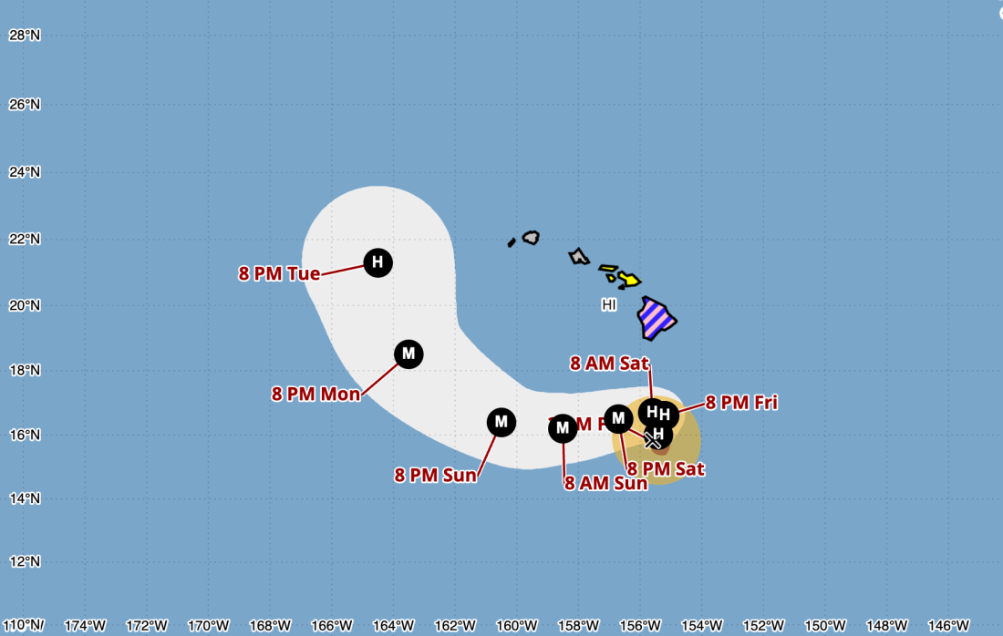
A forecast cone shows the expected movements of Hurricane Nolo as it nears Hawaii's islands. Nolo is expected to avoid making landfall as it strengthens — but forecasters warn it will bring dangerous flooding rains. NOAA/National Weather Service hide caption
toggle caption
NOAA/National Weather Service
People on the Big Island of Hawaii are under a hurricane watch Friday morning, as Hurricane Nolo moves over the Pacific Ocean toward the Hawaiian archipelago. The alert means hurricane conditions are possible within 24 to 36 hours. By then, the storm will likely be a major hurricane, according to the National Hurricane Center (NHC).

Nolo isn't expected to make landfall this weekend, but it has two dangerous qualities: slow movement and heavy rain. Maximum rainfall amounts from the storm in some areas could reach nearly 3 feet, forecasters say, with totals of 15 to 30 inches expected more widely.
"This rainfall could produce catastrophic life-threatening flooding and mudslides, especially in areas of steep terrain," the NHC said in its public advisory.
As of Friday morning, Nolo's maximum sustained winds were at nearly 85 mph and it was moving at only 5 mph. It's now moving north-northeast and is expected to slow to a crawl before turning toward the west and picking up forward speed on Saturday and Sunday.
But it will continue to build strength from warm ocean waters. Over the next 72 hours, Nolo's winds could top out at 140 mph, according to the forecast discussion, making it a Category 4 storm.
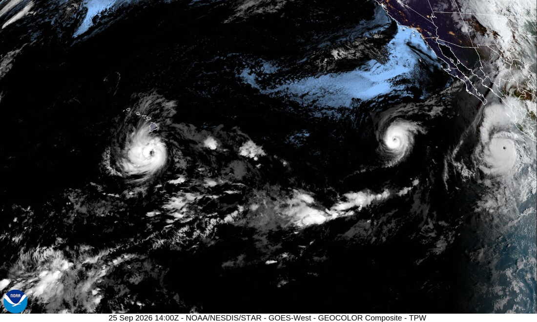
Three hurricanes are spinning in the Pacific Ocean, as seen in this satellite image from Friday morning. In the west, Nolo is bringing rain to Hawaii while to the east, Hurricane Odalys grows over open water. Further east, the powerful Hurricane Polo is threatening Baja California Sur. hide caption
toggle caption
The heaviest rains will likely fall on the Big Island's eastern and southern areas, forecasters say. Neighboring Maui is under a tropical storm watch and could see up to 15 inches of rain.
Nolo's path over the water has been prone to sudden shifts. Earlier this week, it was heading west across open ocean when it took an abrupt right-hand turn, sending it north directly toward the Big Island.
The cyclone is the latest in a busy hurricane season in the Pacific, where warm water is feeding a powerful El Niño phenomenon that's sparking storms and reshaping weather patterns around the world. The Pacific region has already seen three Category 5 hurricanes: Genevieve, Lowell and Polo.
Nolo's growth represents a reversal: Last week, forecasters declared the system was dissipating and would not merit further updates unless it regenerated -- and that's precisely what it did. Days ago, the NHC renewed issuing advisories of Tropical Depression Fifteen-E and warned that it could strengthen quickly. It then became Tropical Storm Nolo before intensifying into a hurricane.